")
Imray Blueback 120-B: North Atlantic – 1907
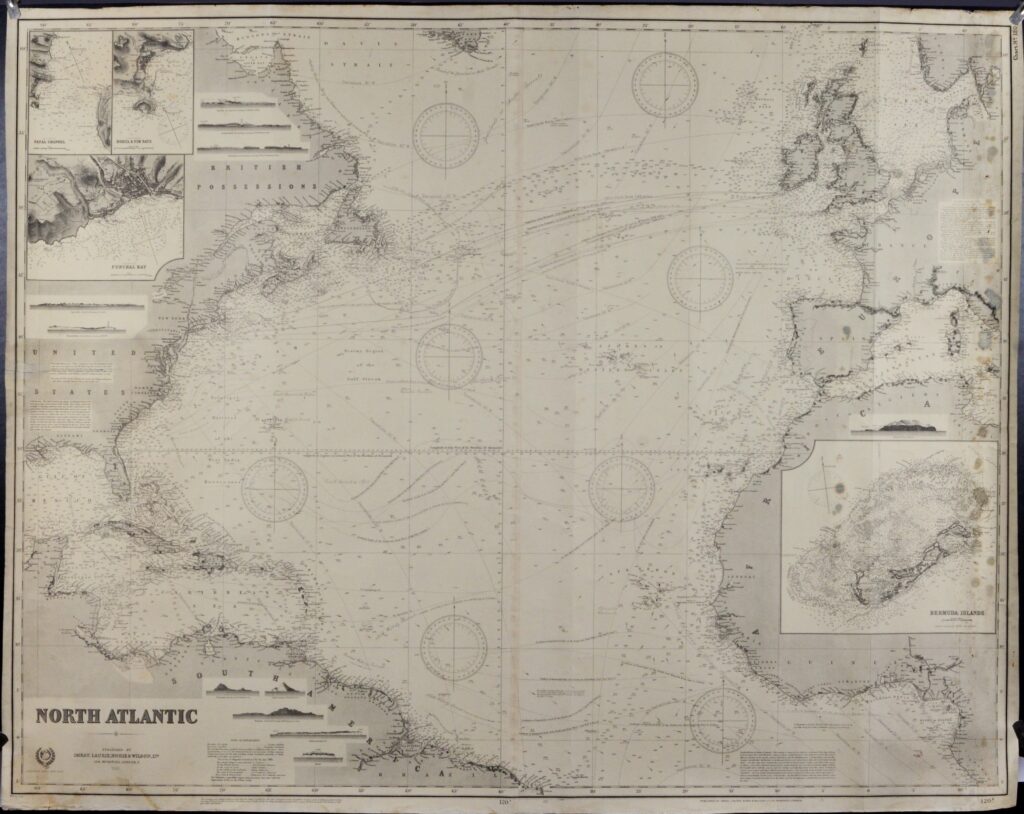
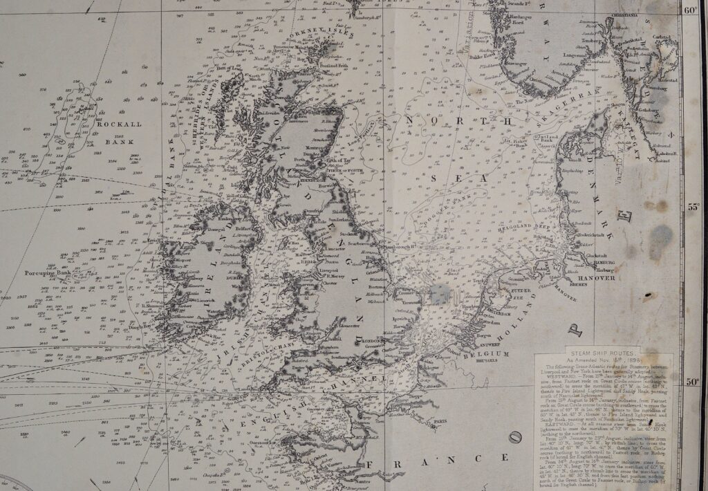
Large and striking sea chart of the North Atlantic made by the legendary sea chart makers James Imray and Son. It includes the East coast of the America’s from the Hudson Strait in the North to the Amazon river near the equator in the South and on the East side, West Africa and western Europe. All countries shown in the situation around 1900. The chart is overall in good condition. On the left side, at 37 degrees, a tear has been repaired. Furthermore, very little damage. This blue back would frame wonderfully.
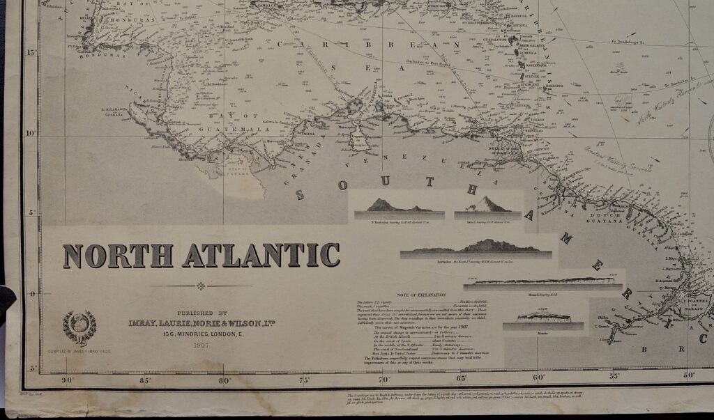
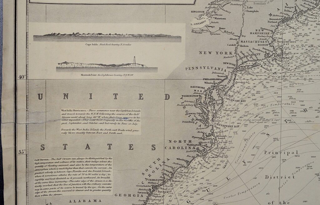
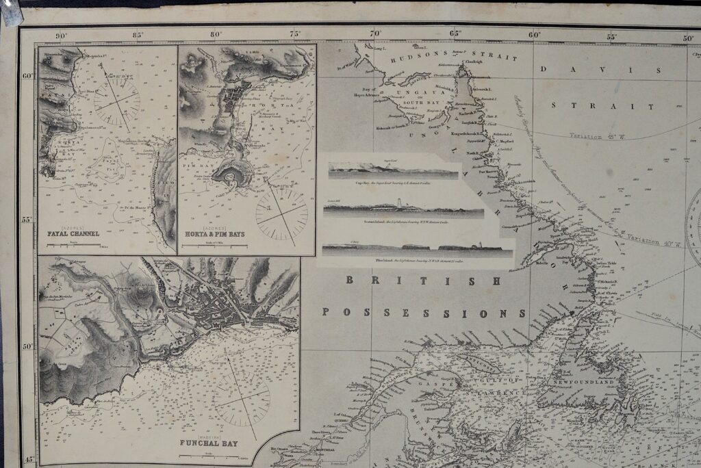
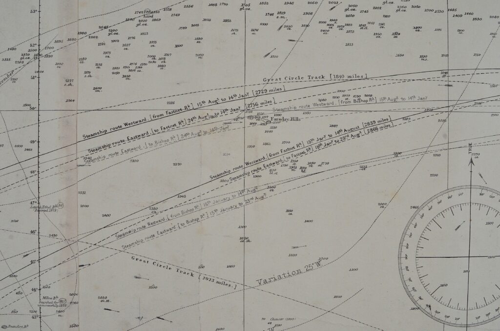
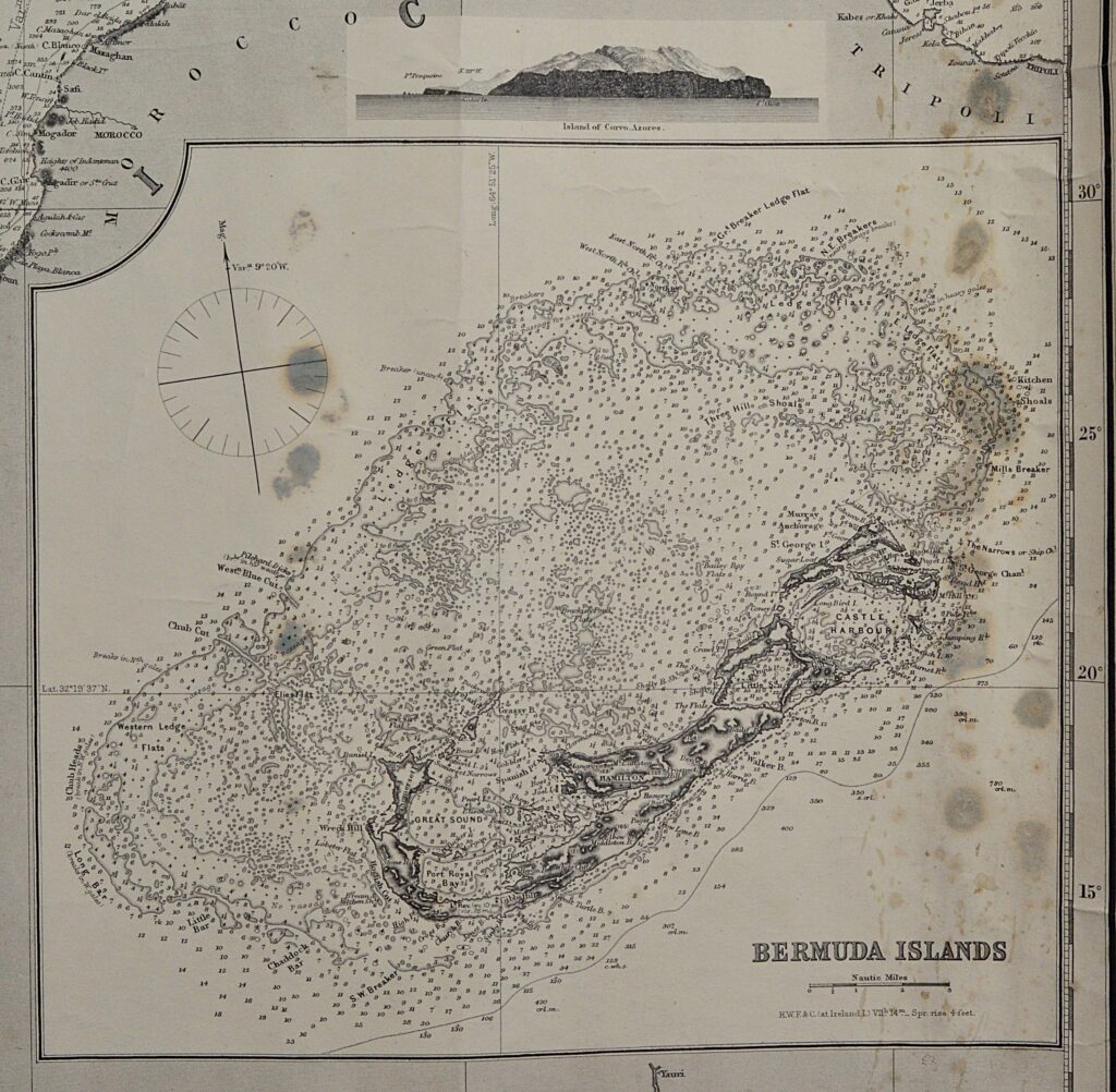
Charts of this format were used as cross over chart to determine courses for long journeys. The chart shows wonderful details and notations on currents and winds as, North African or Guinea Current, Southern limit of seaweed, Principal District of the West India Hurricanes etc. etc. Recommended shipping routes and great circle routes help find the best route over the Atlantic as West Indies to England and Steamship routes westward to New York. Small scale maps show the details of Bermuda, the Azores and Madeira. About ten land views show views of the Azores, St. Eustatius, Saba etc. With the resources available at that time, this provided important information for safe sea navigation in 1900.
Catalog: BK.1-28
Published: 1907
Signed: Imray, Laurie, Norie and Wilson, 156 Minories, London
Dimensions: ca. 104,5 x 134 cm
Condition: VG+, some staining on the right side