
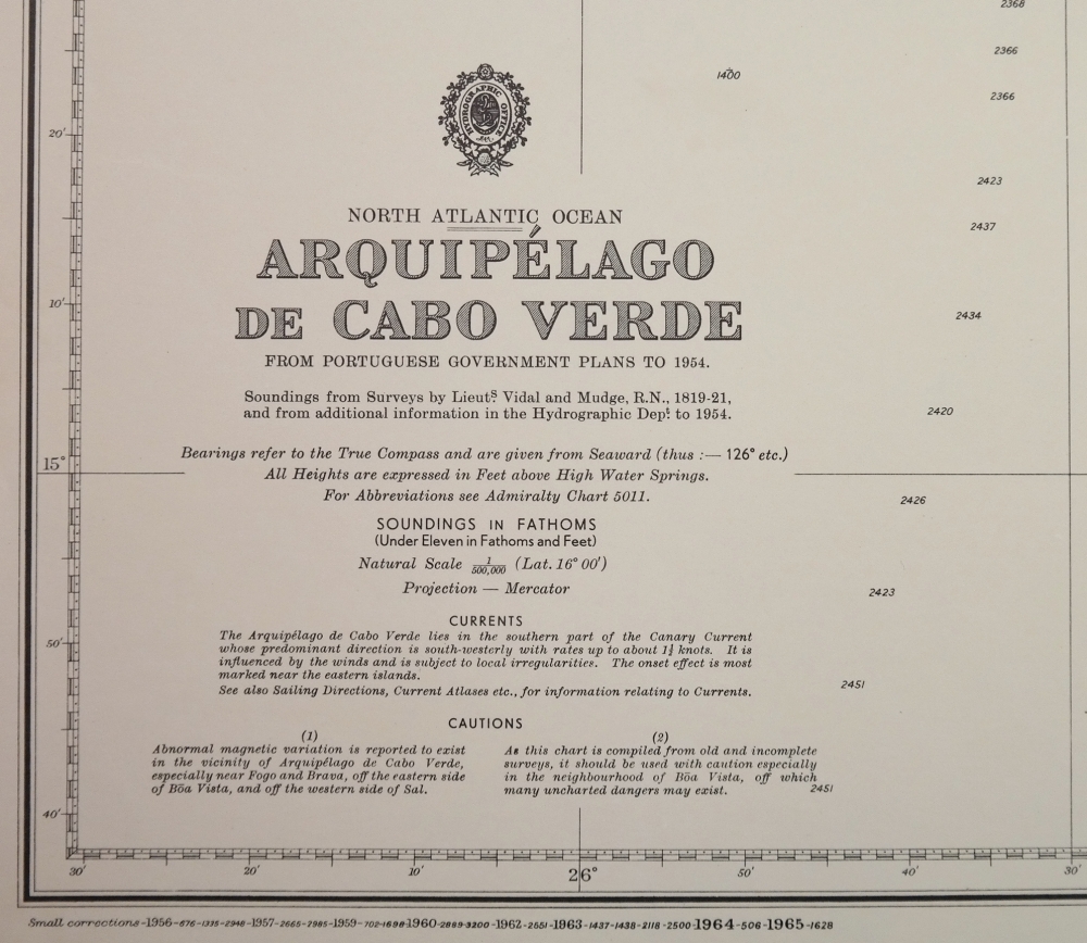
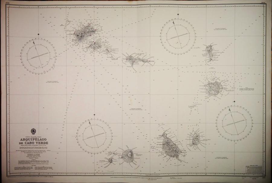
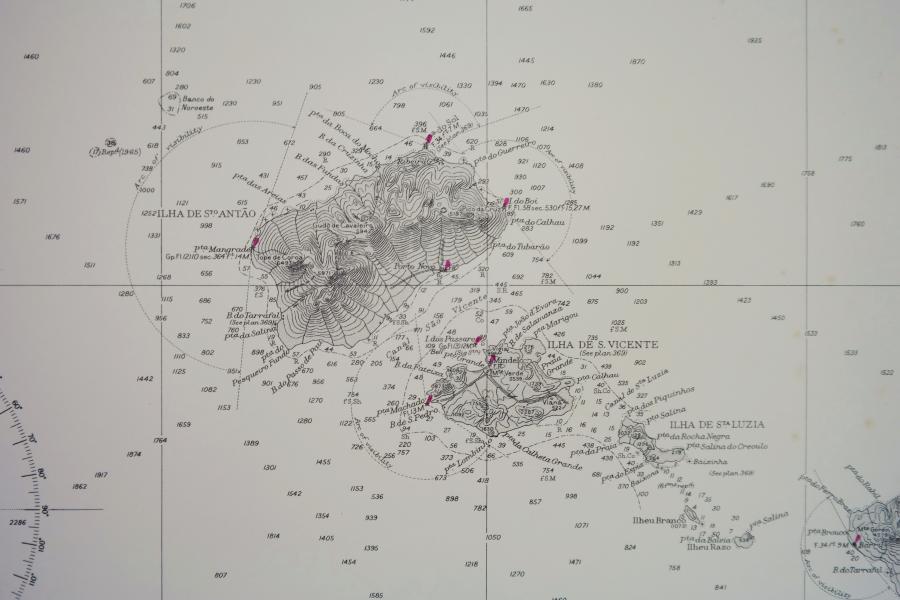
Arquipélago de Cabo Verde – North Atlantic – British Admiralty Chart 366, published 1820
Very detailed and authentic chart with sailing directions, tidal information and so on.
Catalog: AC-366
Surveyed from in 1819-1820 and compiled from Portuguese plans.
1rst Publication 1944
Edition 1944
Dimensions: standard
Condition: VG+
In our chart room are hundreds of Admiralty fathom charts from before WWII. All in good condition, many unused.
Ask for the availability list.