
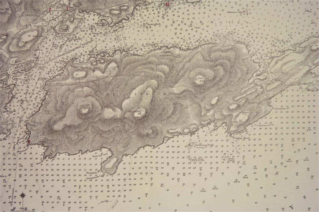
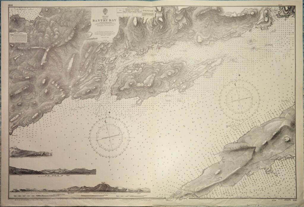
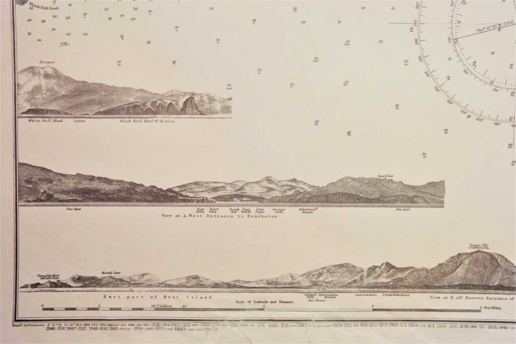
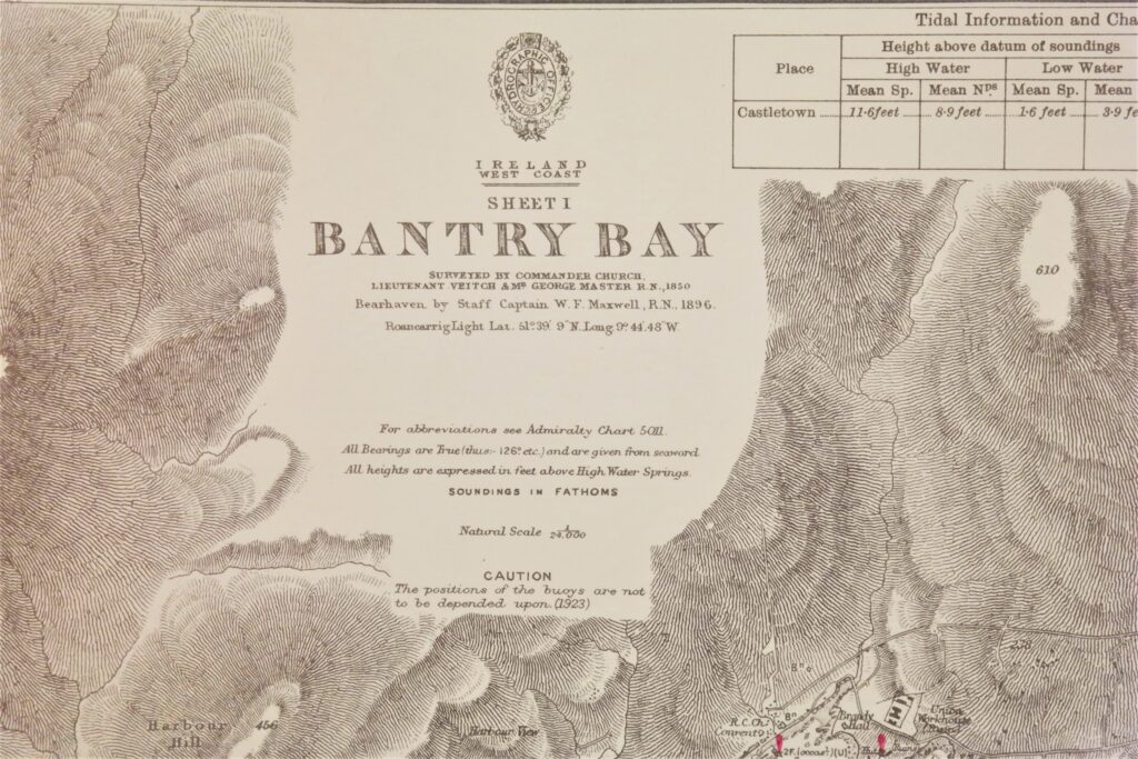
Bantry Bay, sheet 1 – West Coast Ireland – British Admiralty Chart 1840, published in 1856
Impressive and detailed chart of the Bantry Bay in two sheets with land views and light lines. With tidal information. Authentic, very detailed sea chart, no modern copy. On thick paper, folded as issued, suitable for framing. Nice, fresh specimen.
In our chartroom are to find hundreds of British Admiralty sea charts.
Fathom charts, issued before WWII, world wide. All in good condition, many unused.
Ask for the actual availability list.
Catalog: AC-1840
Published: 1856
Edition: 1912
Dimensions: standard
Condition: VG++, unused
Verso: clean, printed title, correction stamp
Sold together with 1838.