
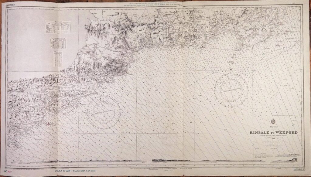

Kinsale to Wexford – Ireland South Coast – British Admiralty Chart 2049, published in 1890
Authentic chart with beautiful land views, tidal information and so on.
With Decca pattern.
Catalog: AC-2049
1rst publication: 1898
Dimensions: large, 71×125 cm (28×49”)
Condition: VG+
In our chart room are hundreds of Admiralty fathom charts from before WWII. All in good condition, many unused.
Ask for the availability list.