")
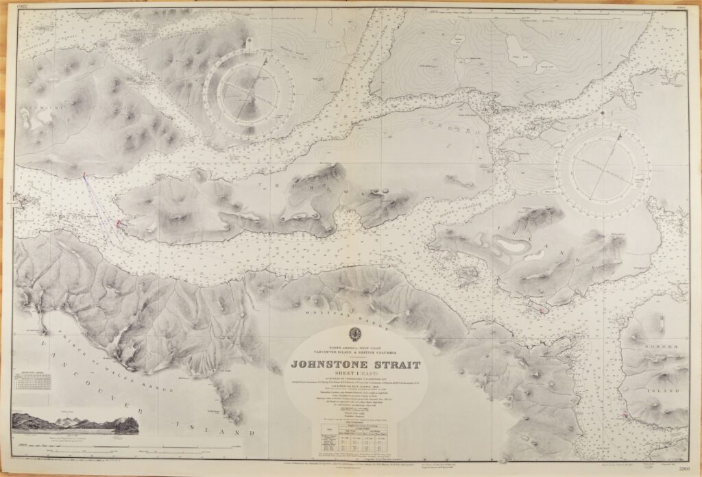
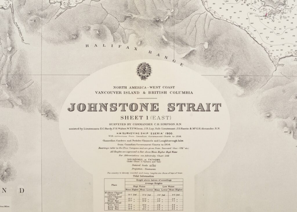

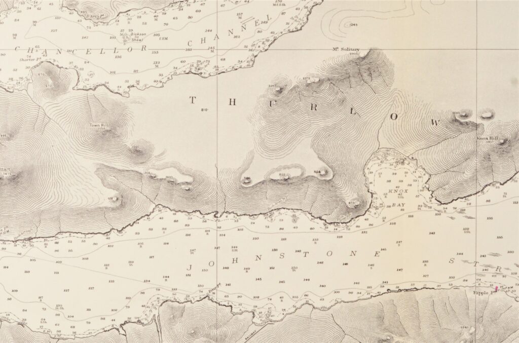
Vancouver Island, British Columbia – British Admiralty Chart 3260, published 1902
Hardly used, small scale chart, of the Johnstone Strait in British Columbia with Vancouver Island and Thurlow island. With beautiful engraved view at the Halifax Range. Authentic sea chart, no copy. On thick paper, folded as issued, suitable for framing.
In our chartroom are to find hundreds of British Admiralty sea charts.
Fathom charts, issued before WWII, world wide. All in good condition, many unused.
Ask for the actual availability list.
Catalog: AC-3260
Surveyed in 1900 with the H.M. Egeria
Published: 1902
Edition: 1943
Dimensions: standard 71×104 cm (28×41 in)
Condition: VG+, very little used