
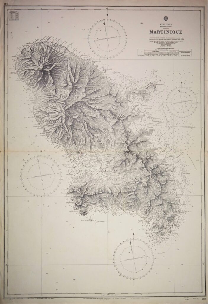
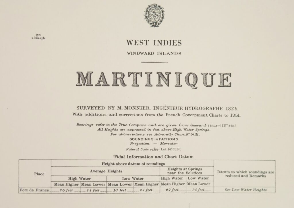
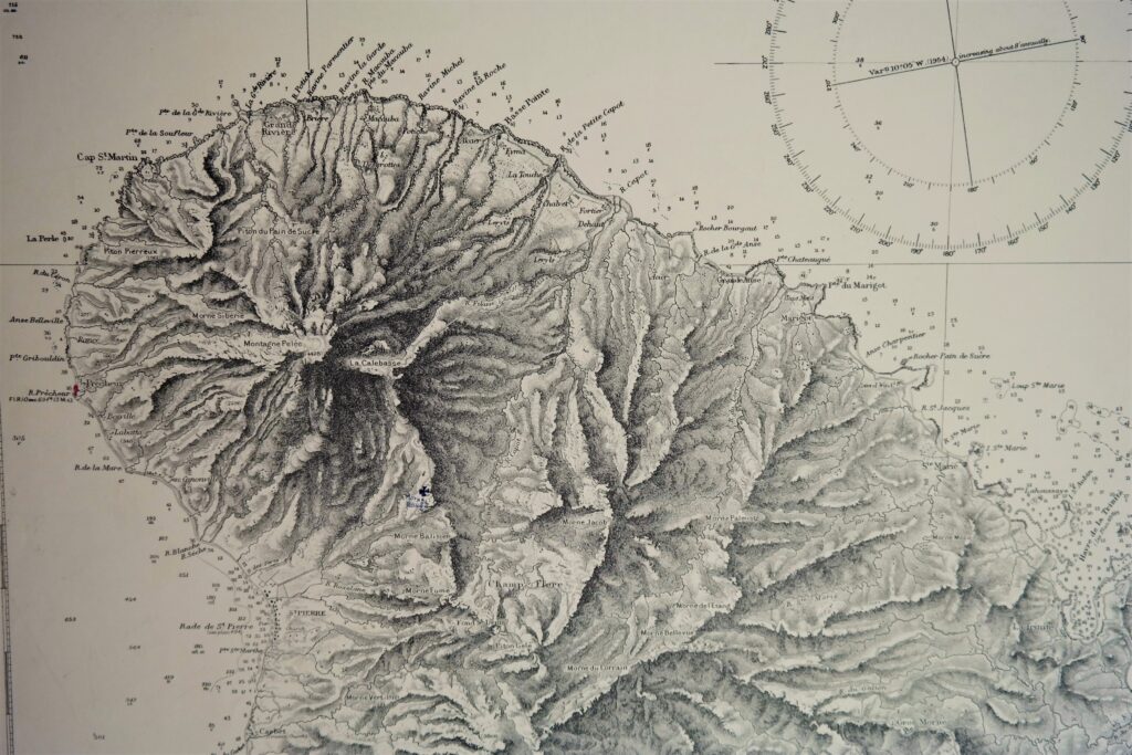
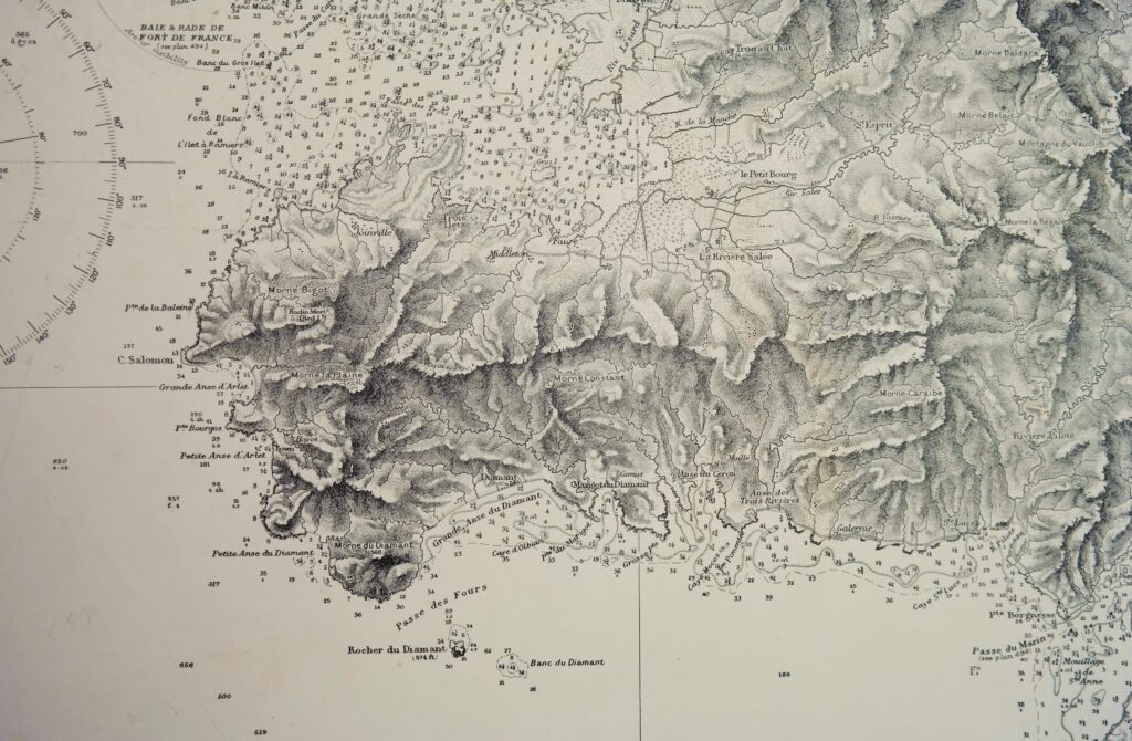
Martinique, West Indies, Windwards Islands – British Admiralty Chart 371, published 1863
Hardly used and very detailed chart of Martinique with the waters around. The entire island with all its mountains has been visualized. The first surveys are from 1825 by the French ingénieur hydrographe M. Monnier. Tidal information is mentioned. Authentic, very detailed sea chart, no modern copy. On thick paper, folded as issued, suitable for framing.
In our chartroom are to find hundreds of British Admiralty sea charts.
Fathom charts, issued before WWII, world wide. All in good condition, many unused.
Ask for the actual availability list.
Catalog: AC-371
Published: 1863
Edition: 1951
Dimensions: standard 71×104 cm (28×41 in)
Condition: VG, margins below and above slightly wrinkled, some small tears in the right edge, practically invisible sealed at the back
Verso: clean, printed title, stamps of the Amsterdam Nautical and Meteorological Institute