")
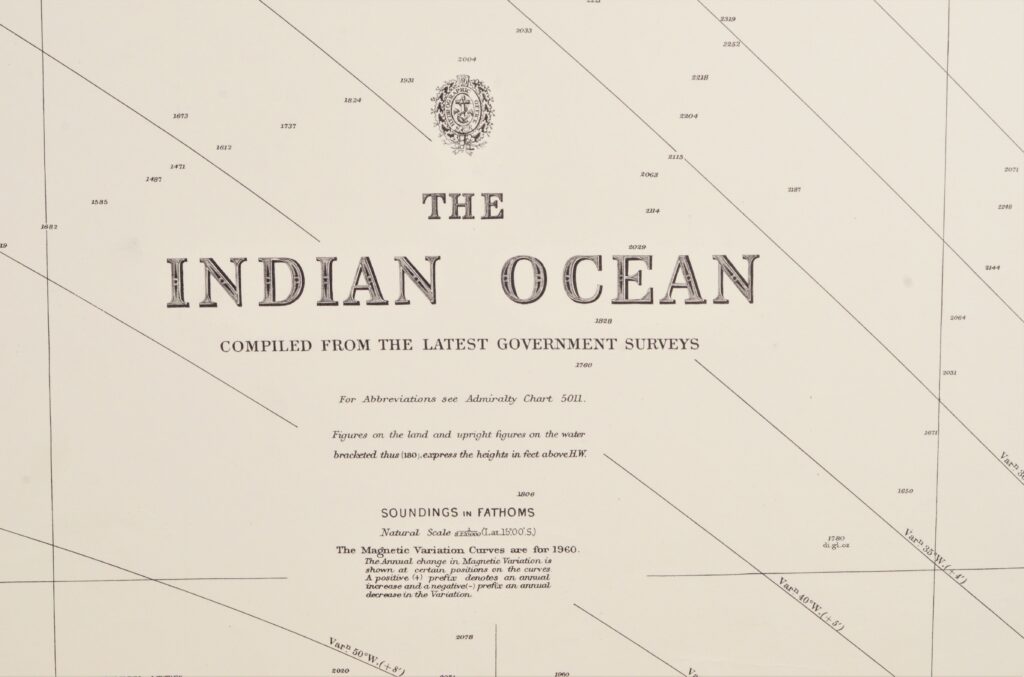
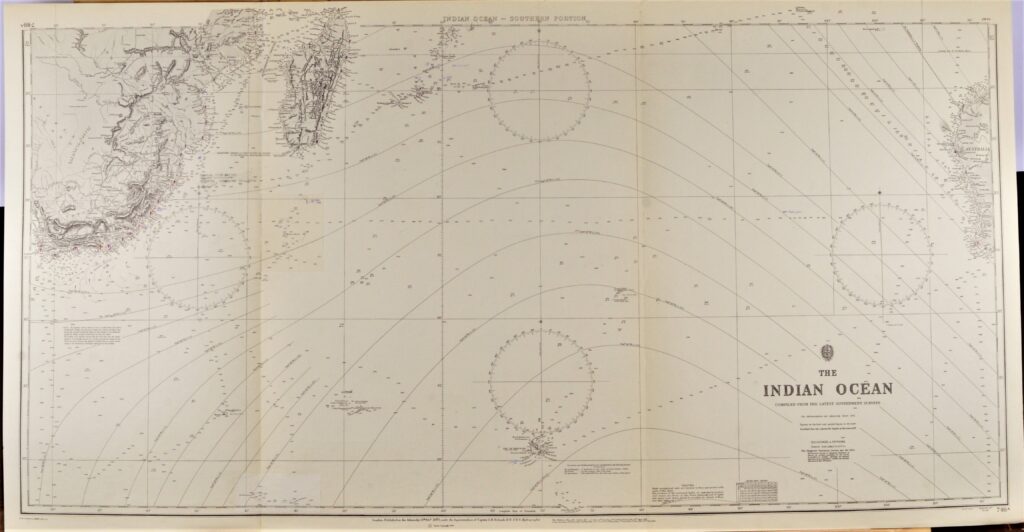
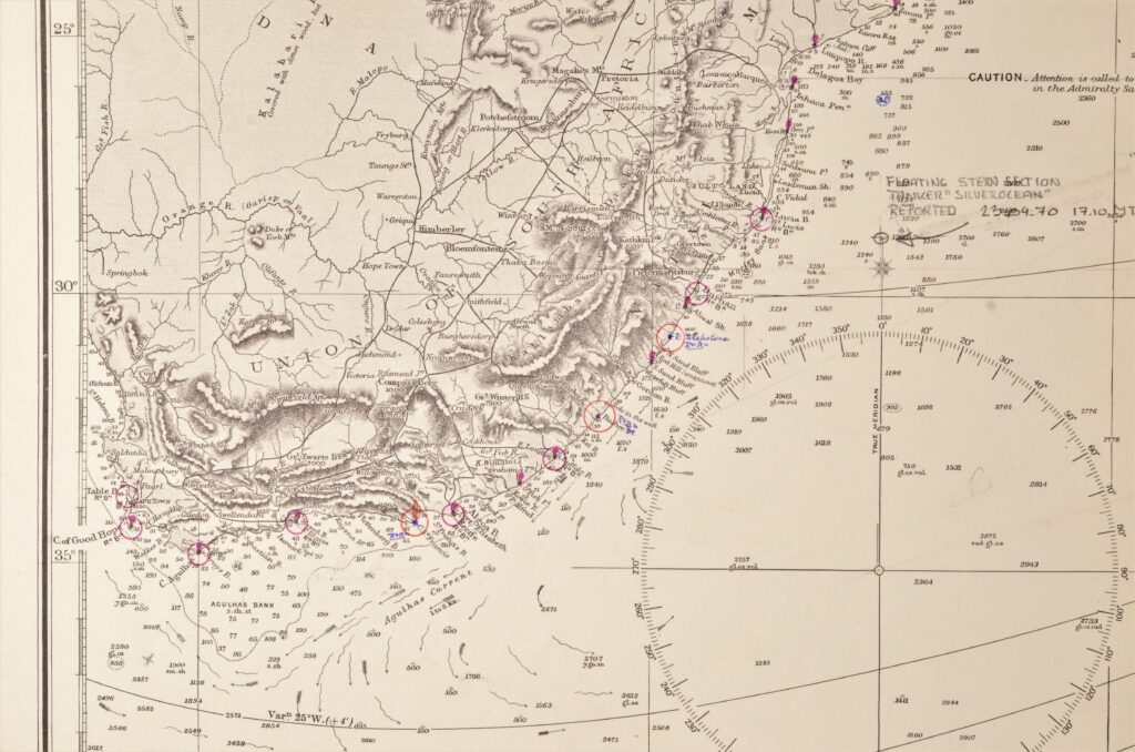
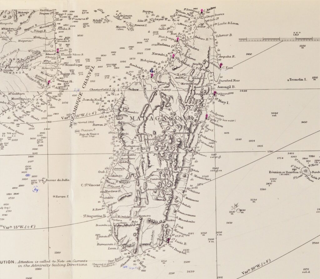
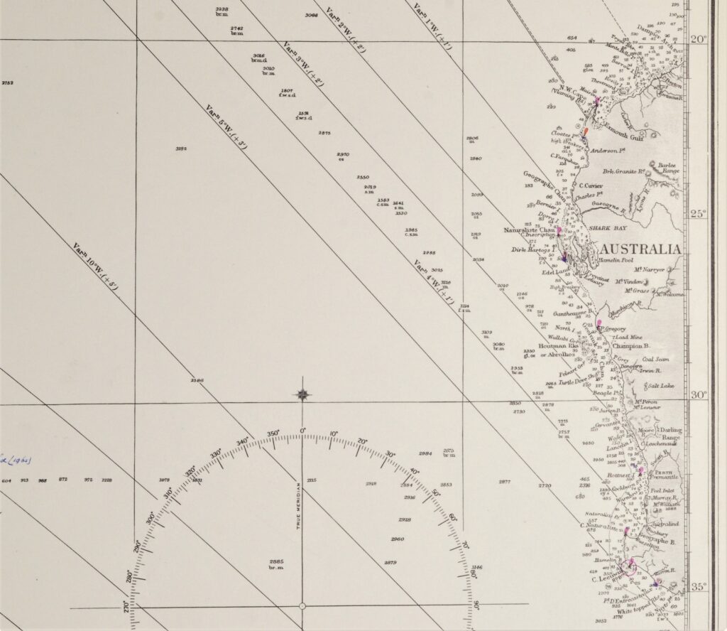

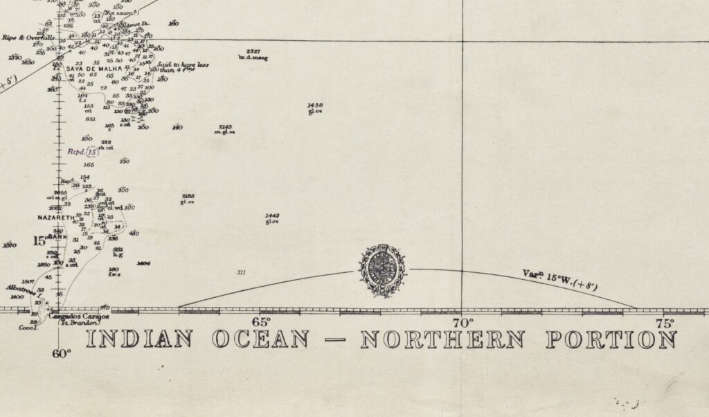
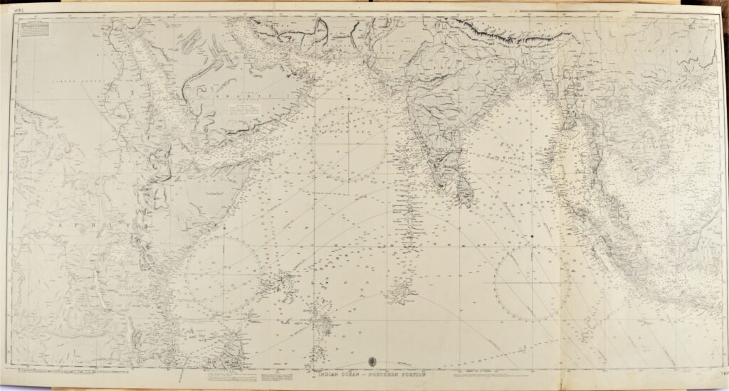
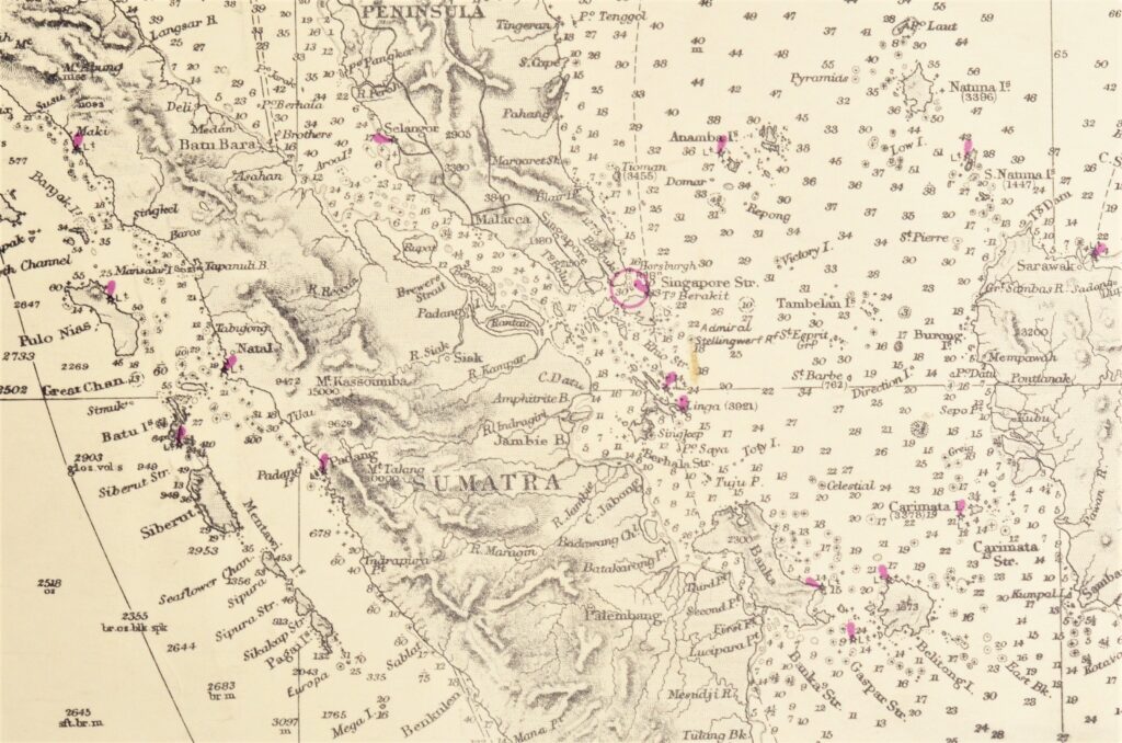
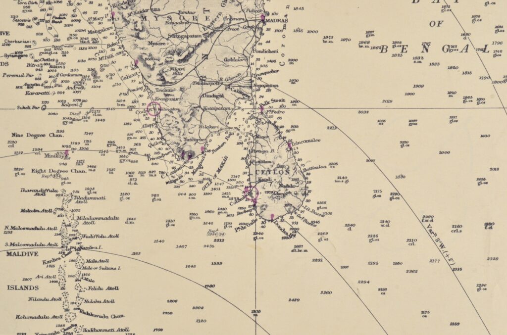
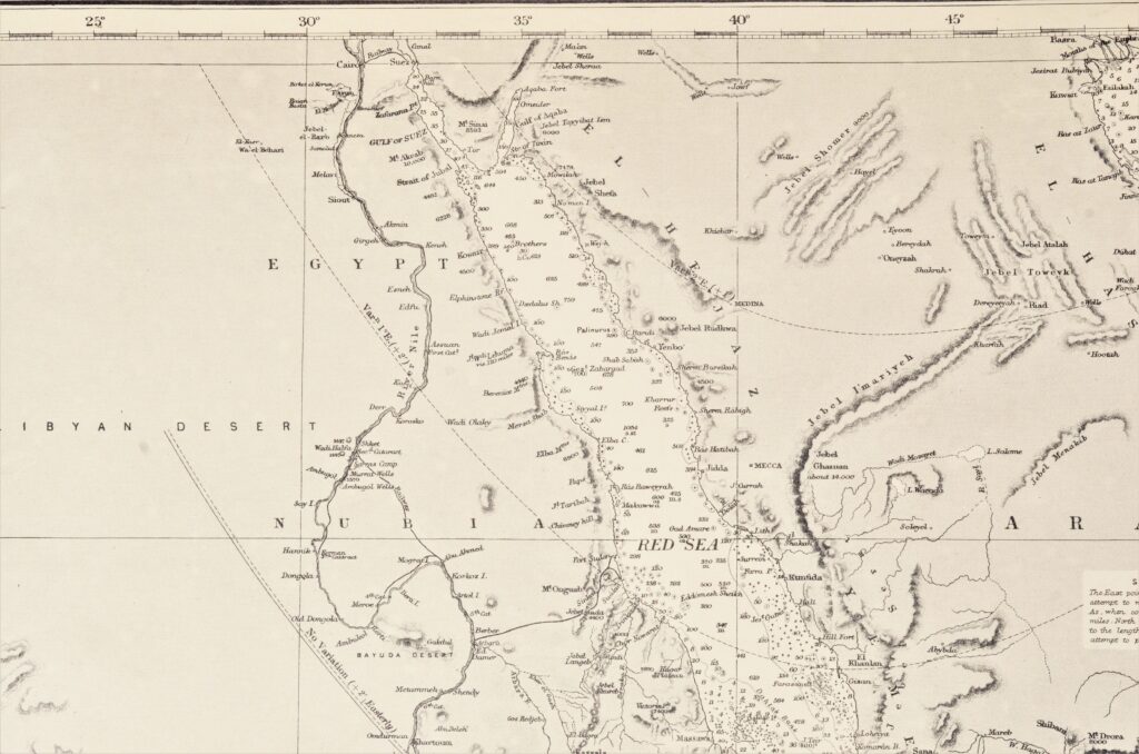
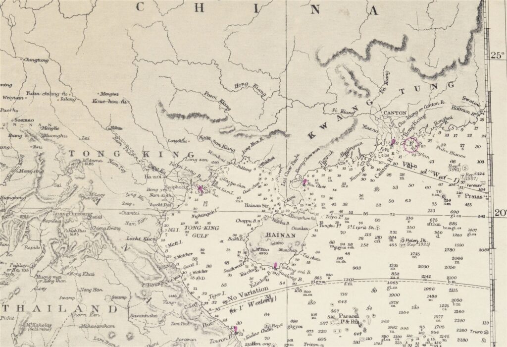
The Indian Ocean in two sheets – British Admiralty Chart 748A and B, published 1870
Two authentic and very large cross over charts of the Indian Ocean between Africa and Australia. And from the Himalaya in the North to the Roaring Fourties and the Furious Fifties in the South. Authentic sea charts, no copies, with two NtM corrections. On thick paper, folded as issued, suitable for framing.
In our chartroom are to find hundreds of British Admiralty sea charts.
Fathom charts, issued before WWII, world wide. All in good condition, many unused.
Ask for the actual availability list.
Compiled of the latest Government surveys
Catalog: AC-748
Published: 1870
Edition: 1923
Dimensions: large, 71×136 cm (28×53,5 in)
Condition: VG+, very little used, 748B with small, hardly visible restauration lower edge