
Kinsale to Wexford – Ireland South Coast – British Admiralty Chart 2049, published in 1890
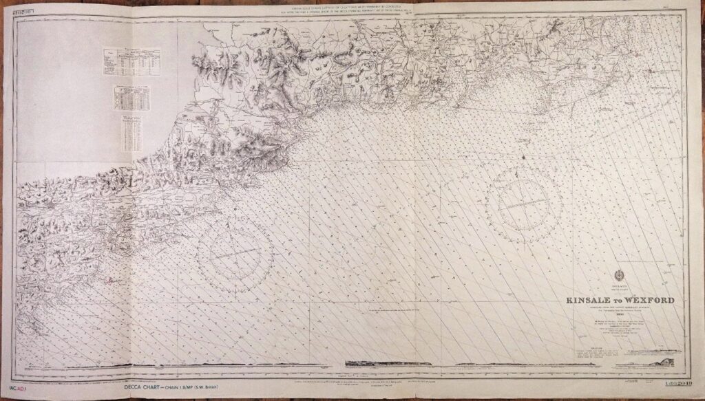
Authentic chart with beautiful land views, tidal information and so on. With Decca pattern. Catalog: AC-2049 1rst publication: 1898 Dimensions: large, 71×125 cm (28×49”) Condition: VG+ In our chart room are hundreds of Admiralty fathom charts from before WWII. All in good condition, many unused. Ask for the availability list.
Read MoreDutch Indies – Western and Eastern portions of the Eastern Archipelago – British Admiralty Chart 941a/b and 942a/b in 4 sheets, published 1867 – 1920

Four consecutive and detailed charts with the whole Indonesian archipelago from Singapore to Australia, including the southern and eastern passages to China and the Java, Flores and Banda Seas. Survey, compiled from the most recent Brittish and Netherlands surveys 1rst publication: 1867/1868 Additions and corrections to 1949/1955 Dimensions: standard 71×104 cm (28×41”) Catalog: AC-941 Condition:…
Read MoreDover Strait – England South Coast – British Admiralty Chart 1895, published in 1942
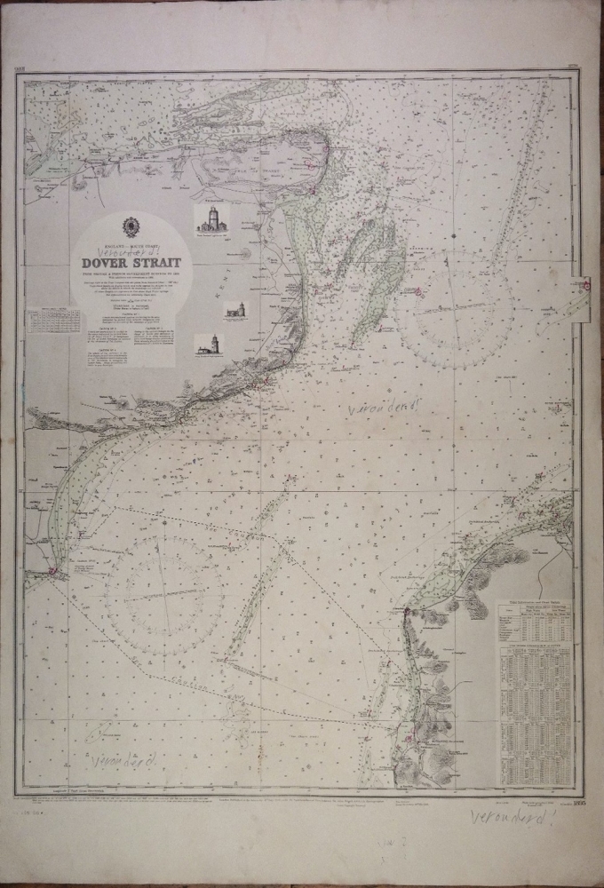
Authentic photo-litho with beautiful ligthhouses, tidal information and so on. Catalog: AC-1895 1rst publication: 1942 Additions and corrections to 1955 Dimensions: standard 71×104 cm (28×41”) Condition: G with a single slight fold, marked with pen ’verouderd’ In our chart room are to find hundreds of Admiralty fathom charts from before WWII. World wide, all in…
Read MoreGuernsey, Herm & Sark – the English Channel Islands – British Admiralty Chart 262a, published 1862.
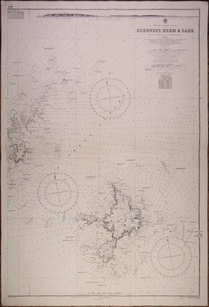
Authentic chart with land views, sailing directions, tidal information and so on. Catalog: AC-262a Surveyed from 1859 -1862 Engraved in 1863 Additions and corrections to 1954 Dimensions: standard 71×104 cm (28×41”) Condition: VG In our chart room are to find hundreds of Admiralty fathom charts from before WWII. World wide, all in good condition, many…
Read MoreAlderney & the Casquets – the English Channel Islands – British Admiralty Chart 60, published 1863
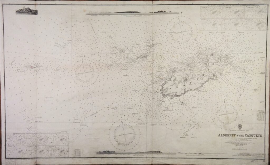
Authentic chart, widely used, with beautiful details as land views, ligthhouses, tidal information and so on. Catalog: AC-60 Surveyed from 1859 – 1863 Engraved: 1865 Dimensions: large, 71×134 cm (28×52,8”) Condition: G, widely used In our chart room are to find hundreds of Admiralty fathom charts from before WWII. World wide, all in good condition,…
Read MoreNewfoundland, North America – British Admiralty Chart 282, published 1882
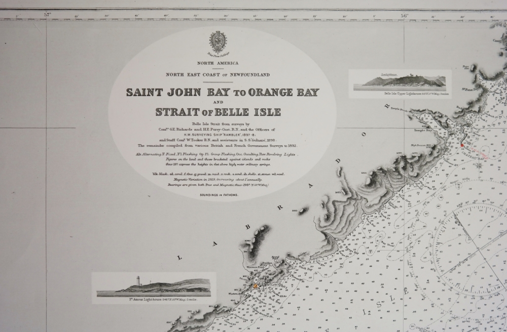
Very detailed and authentic chart with landviews, sailing directions, tidal information and so on. Catalog: AC-282 Surveyed from in 1897-1898 Engraved: 1882 Edition: 1913 Dimensions: standard Condition: VG+ In our chart room are to find hundreds of Admiralty fathom charts from before WWII. World wide, all in good condition, many unused. Ask for the availability…
Read MoreParallel Ruler, brass and ebony
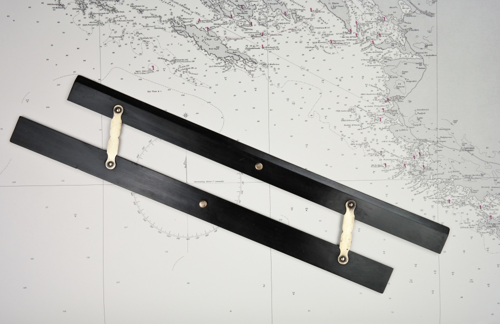
Rulers like this one are used to plot course lines and bearings on nautical charts. They can be rolled across the chart to the compass rose without changing its orientation. Catalog: NM.3-20 Date: ca. 1900 WL: 50×7 cm (19,5×2.8 in) Signed: not signed Origin: unknown Condition: in good working condition, wear consistent with age and…
Read MoreParallel Ruler, brass and ebony – 19th century

Nice decorated parallel ruler. Rulers like this one are used to plot course lines and bearings on nautical charts. They can be rolled across the chart to the compass rose without changing its orientation. Catalog: NM.3-16 Date: 19th century WL: 33×5,2 cm (13×2 in) Signed: not signed Origin: English Condition: in good working condition, wear…
Read MoreRolling Ruler – England, late 19th century
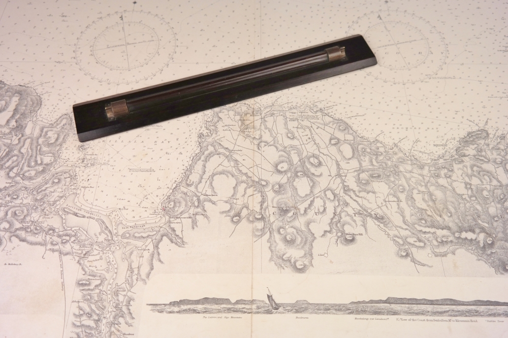
Heavy rolling ruler of rosewood with brass rollers. Rulers like this one are used to plot course lines and bearings on nautical charts. They can be rolled across the chart to the compass rose without changing its orientation. Catalog: NM.3-14 Date: 1880-1910 WL: 39×6 cm (15,3×2,3 in) Signed: not signed Origin: England Condition: perfect
Read More