Chartroom
Archipel International Maritime Gallery is a gold mine for fans of old and antique sea charts. The collection consists mainly of British Admiralty Charts, but only a few are shown. If you are interested in a specific nautical chart, please do not hesitate to inquire. A up-to-date overview in excel is available. The charts are in good condition, most of them are not or little used.
The charts are valued as follows:
VG++ unused chart
VG+ little used clean chart, light handling marks and creases
VG good sea chart, handling marks more emphatically present
G good sea chart with clearly present traces of use
G- historically interesting map but with flaws
Slight signs of use, small defects and repairs which do not detract the image of the chart, are not mentioned.
The dimensions of the charts are indicated with:
Standard size, 71×104 cm or 28×41 inch
Half size, 71×52 cm or 28×20,5 inch
Large size, 71 cm wide but larger then the standard format
The Hydrographic Office of the British Navy has been in existence since 1797. Over 3500 navigatinonal charts are published with supporting items such as Sailing Directions (Pilots), Tide Tables, Lights and radio Signal Lists. They give a complete world cover for shipping of every size. The surveys are mostly made by ships of the Royal Navy.
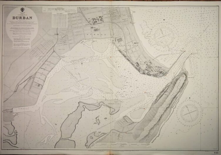
Very nice engraved and detailed sea chart of the port of Durban (Port Natal). Authentic, very detailed sea chart, no modern copy. On thick paper, folded as issued, suitable for framing. Nice, fresh specimen.
In our chartroom are to find hundreds of British Admiralty sea charts.
Fathom charts, issued before WWII, world wide. All in good condition, many unused.
Ask for the actual availability list.
Catalog: AC-643
Published: 1924
Edition: 1963
Dimensions: standard 71×104 cm (28×41 in)
Condition: VG++, unused
Verso: printed title, stamp with correction data
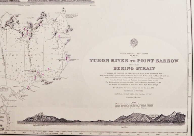
Very detailed and authentic chart of the Bering Street between Alaska and Russia. With beautiful views of snowy mountains. Authentic, unused sea chart, no copy, with names as Cape Prince of Wales, Cape York, Cape Lisburne. On thick paper, folded as issued, suitable for framing. Sold together with BAC 654, the Western part of the Bering Street.
In our chartroom are to find hundreds of British Admiralty sea charts.
Fathom charts, issued before WWII, world wide. All in good condition, many unused.
Ask for the actual availability list.
Catalog: AC-593
Surveyed: 1826-1827
Published: 1907
Edition: 1923
Dimensions: standard 71×104 cm (28×41 in)
Condition: VG++, unused
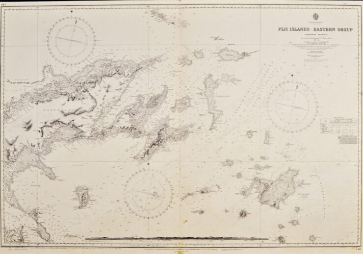
Very nice engraved and detailed sea chart of the Fiji Islands with land view of the Nasavusavu Bay. The first surveys are from 1878 to 1881 by Captain W.U. Moore. Tidal information is mentioned. Authentic, very detailed sea chart, no modern copy. On thick paper, folded as issued, suitable for framing. Nice, fresh specimen.
In our chartroom are to find hundreds of British Admiralty sea charts.
Fathom charts, issued before WWII, world wide. All in good condition, many unused.
Ask for the actual availability list.
Catalog: AC-440
Surveyed in 1878 – 1881
Published: 1883
Dimensions: standard 71×104 cm (28×41 in)
Condition: VG, used, inconspicuous defects
Verso: printed title, stamps with correction data
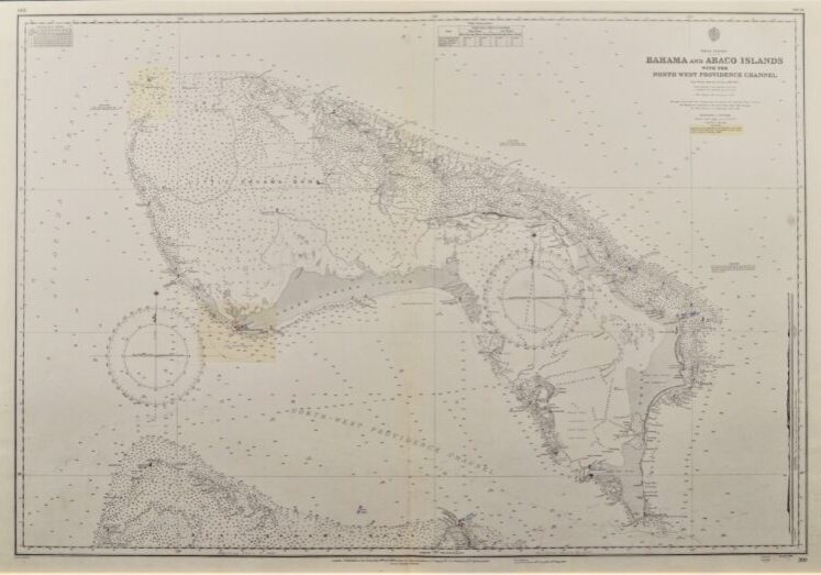
Hardly used, detailed sea chart of the Bahama’s and Abaco Islands. With beautiful engraved view of the Abaco light-house. The first surveys dates from 1835. Tidal information is mentioned for the most important ports. Authentic, very detailed sea chart, no modern copy. On thick paper, folded as issued, suitable for framing. Nice, fresh specimen.
In our chartroom are to find hundreds of British Admiralty sea charts.
Fathom charts, issued before WWII, world wide. All in good condition, many unused.
Ask for the actual availability list.
Catalog: AC-399
Surveyed: 1836 – 1885
Published: 1886
Edition: 1rst edition
Dimensions: standard 71×104 cm (28×41 in)
Condition: VG, used, inconspicuous defects
Verso: clean, title on label, stamps with correction data
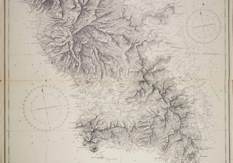
Hardly used and very detailed chart of Martinique with the waters around. The entire island with all its mountains has been visualized. The first surveys are from 1825 by the French ingénieur hydrographe M. Monnier. Tidal information is mentioned. Authentic, very detailed sea chart, no modern copy. On thick paper, folded as issued, suitable for framing.
In our chartroom are to find hundreds of British Admiralty sea charts.
Fathom charts, issued before WWII, world wide. All in good condition, many unused.
Ask for the actual availability list.
Catalog: AC-371
Published: 1863
Edition: 1951
Dimensions: standard 71×104 cm (28×41 in)
Condition: VG, margins below and above slightly wrinkled, some small tears in the right edge, practically invisible sealed at the back
Verso: clean, printed title, stamps of the Amsterdam Nautical and Meteorological Institute
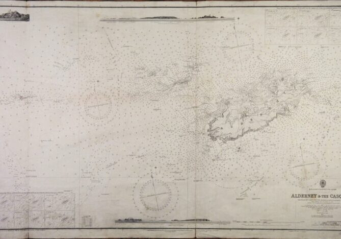
Impressive and very detailed chart of the Channel islands with beautiful views at the islands and the Casquet and Noir Rock lighthouse. Authentic, unused sea chart with Decca inprint. On thick paper, folded as issued, suitable for framing.
In our chartroom are to find hundreds of British Admiralty sea charts.
Fathom charts, issued before WWII, world wide. All in good condition, many unused.
Ask for the actual availability list.
Catalog: AC-60
Surveyed from 1859 – 1863
Published: 1865
Edition: 4
Dimensions: large, 71×134 cm (28×52,8 in)
Condition: G, widely used
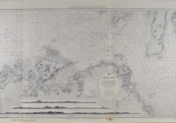
Impressive and very detailed chart of the North coast of Ireland with beautiful views at Paps of Jura, Horn Head, Bloody Foreland Hill and so on. Authentic, unused sea chart with Decca inprint. On thick paper, folded as issued, suitable for framing.
In our chartroom are to find hundreds of British Admiralty sea charts.
Fathom charts, issued before WWII, world wide. All in good condition, many unused.
Ask for the actual availability list.
Catalog: AC-46
Surveyed: 1853-1859
Published: 1861
Edition: 1914
Dimensions: large 71×130 cm (28×51 in)
Condition: VG, used, inconspicuous defects, bit foxing
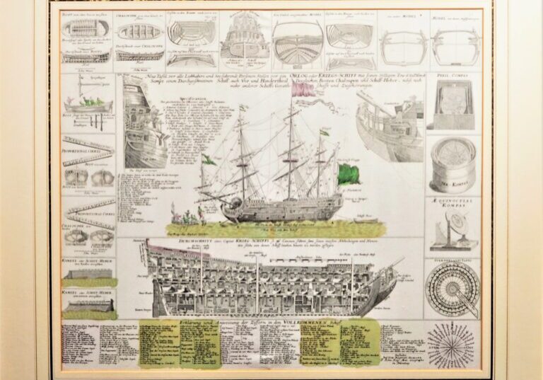
Neue Tafel vor alle Liebhabers und See-fahrende Personen stellet vor ein Orlogs oder Krieg-shiff mit seinen folligen Tow & Seilwerk sampt einem durchgesnitten Shiff, auch Vor und Hintertheil desgleichen Booten, Chaloupen und Shiff-Heber und nebst noch mehr anderer Shiffs Geraeth Shafft und Zugehörungen.
Very rare and large old coloured engraving of a warship’s with cross section and seventeen diagrams around. Made by the famous cartograph Johann Baptist Homann and published around 1720 in Nuremberg and is still in good condition. The diagrams show navigation instruments, ship types, cross sections including an admiral ship. The cross section shows a very detailed interior of the ship with extensive key. The print was occasionally included in the great Homann atlas, Atlas novus terrarum orbis imperia regna et status exactis tabulis geographice demonstrans.
Catalog: BK.1-20
Signed: Joh. Baptist Homann,
Engraved: c.1720
HW plate: 48,5 x 57 cm
HW sheet: 54 x 62.5 cm
Carton frame: 66 x 74 cm
Condition: VG
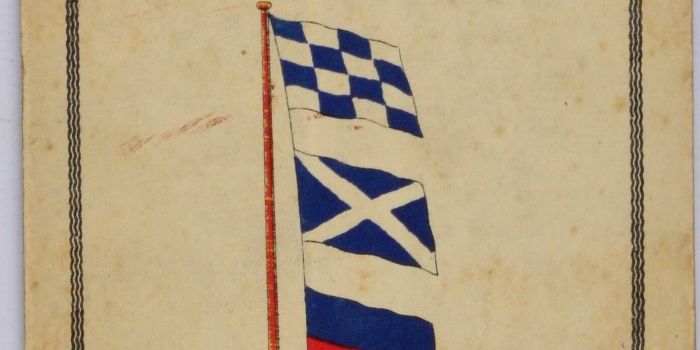
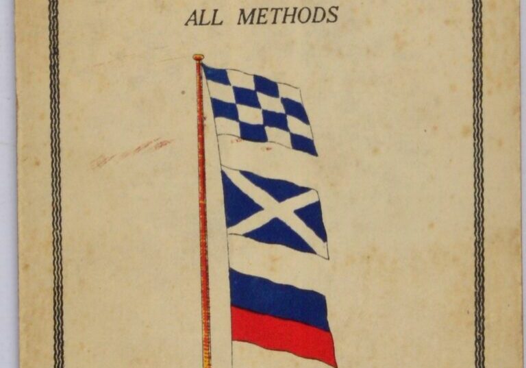
Four pieces of card 11×17 cm, hinged together as a handy and compact summary of international signals at sea to be distinguished from the Brown’s International Guide to Signal.
Catalog: BK.1-17
Date: ca. 1955
HW: 11×17 cm
Publisher: Brown, Son & Ferguson Ltd., Glasgow
Origin: England
Condition: in good condition with signs of use
